Property Record
830 Taraval St, San Francisco, CA 94116


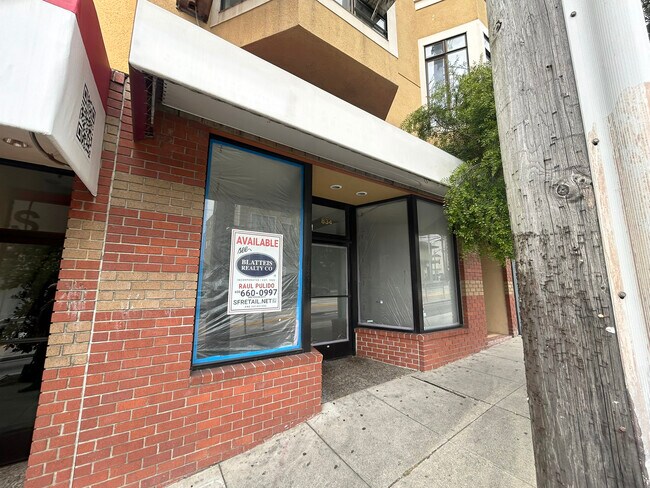
Current Lease Availabilities
NEARBY LISTINGS FOR SALE OR LEASE
Property Detail
830 Taraval St
San Francisco
Sunset Bl 1120
San Francisco-Redwood City-South San Francisco, CA
PARCEL MAPS 32 PG 94 BLK 1120 LOT 28
2347-028
San Francisco
Storemultistory
California
2024
28
2025
0.06 AC
030400
Southern City
4,125 SF
DEMOGRAPHICS near 830 Taraval St
1 Mile
3 Mile
5 Mile
2024 Total Population
38,078
369,700
800,183
2029 Population
34,706
340,326
740,760
Pop Growth 2024-2029
(8.86%)
(7.95%)
(7.43%)
Average Age
46
43
42
2024 Total Households
13,440
141,904
325,037
HH Growth 2024-2029
(9.46%)
(8.30%)
(7.81%)
Median Household Inc
$147,717
$136,880
$123,970
Avg Household Size
2.70
2.50
2.30
2024 Avg HH Vehicles
2.00
1.00
1.00
Median Home Value
$1,130,597
$1,108,581
$1,091,807
Median Year Built
1946
1947
1949
Nearby Places
Map Layers
Map Styles
 Street
 Aerial
- Restaurants
- Banks
- Shops
- Fitness
- Groceries
PUBLIC TRANSPORTATION
TRANSIT/SUBWAY
West Portal and 14th Avenue (K Ingleside - San Francisco Municipal Railway (MUNI Metro), M Ocean View - San Francisco Municipal Railway (MUNI Metro))
DRIVE
WALK
Distance
West Portal and 14th Avenue (K Ingleside - San Francisco Municipal Railway (MUNI Metro), M Ocean View - San Francisco Municipal Railway (MUNI Metro))
2 min
13 min
0.6 mi
West Portal (K Ingleside - San Francisco Municipal Railway (MUNI Metro), L Taraval - San Francisco Municipal Railway (MUNI Metro), M Ocean View - San Francisco Municipal Railway (MUNI Metro), T Third Street - San Francisco Municipal Railway (MUNI Metro))
DRIVE
WALK
Distance
West Portal (K Ingleside - San Francisco Municipal Railway (MUNI Metro), L Taraval - San Francisco Municipal Railway (MUNI Metro), M Ocean View - San Francisco Municipal Railway (MUNI Metro), T Third Street - San Francisco Municipal Railway (MUNI Metro))
2 min
13 min
0.7 mi
Saint Francis Circle (K Ingleside - San Francisco Municipal Railway (MUNI Metro), M Ocean View - San Francisco Municipal Railway (MUNI Metro))
DRIVE
WALK
Distance
Saint Francis Circle (K Ingleside - San Francisco Municipal Railway (MUNI Metro), M Ocean View - San Francisco Municipal Railway (MUNI Metro))
3 min
16 min
0.8 mi
Ocean (M Ocean View - San Francisco Municipal Railway (MUNI Metro))
DRIVE
WALK
Distance
Ocean (M Ocean View - San Francisco Municipal Railway (MUNI Metro))
3 min
16 min
0.8 mi
Junipero Serra and Ocean (K Ingleside - San Francisco Municipal Railway (MUNI Metro))
DRIVE
WALK
Distance
Junipero Serra and Ocean (K Ingleside - San Francisco Municipal Railway (MUNI Metro))
3 min
19 min
1.0 mi
COMMUTER RAIL
DRIVE
WALK
Distance
14 min
6.4 mi
DRIVE
WALK
Distance
14 min
7.4 mi
AIRPORT
San Francisco International
DRIVE
WALK
Distance
San Francisco International
22 min
12.9 mi
Metro Oakland International
DRIVE
WALK
Distance
Metro Oakland International
44 min
27.0 mi
Norman Y Mineta San Jose International
DRIVE
WALK
Distance
Norman Y Mineta San Jose International
58 min
44.5 mi
Freight Ports
Port of San Francisco
DRIVE
WALK
Distance
Port of San Francisco
19 min
8.1 mi
Nearby Properties
Address
Land Use
TOTAL SIZE
Lot Size
Zoning
Address
Land Use
TOTAL SIZE
Lot Size
Zoning
248,303 SF
4.35 AC
Address
Land Use
TOTAL SIZE
Lot Size
Zoning
411,904 SF
21.74 AC
C2
Address
Land Use
TOTAL SIZE
Lot Size
Zoning
718 SF
18.55 AC
RH2
Address
Land Use
TOTAL SIZE
Lot Size
Zoning
346,710 SF
7.45 AC
RH2
Address
Land Use
TOTAL SIZE
Lot Size
Zoning
409,895 SF
7.20 AC
RH3
Address
Land Use
TOTAL SIZE
Lot Size
Zoning
312,191 SF
2.74 AC
Address
Land Use
TOTAL SIZE
Lot Size
Zoning
17.91 AC
RH-2
Address
Land Use
TOTAL SIZE
Lot Size
Zoning
4.41 AC
RH-3/RM-2
Address
Land Use
TOTAL SIZE
Lot Size
Zoning
230,310 SF
0.65 AC
NC3
Address
Land Use
TOTAL SIZE
Lot Size
Zoning
2.03 AC
C2
Address
Land Use
TOTAL SIZE
Lot Size
Zoning
88,900 SF
5.37 AC
NCS
Address
Land Use
TOTAL SIZE
Lot Size
Zoning
11.31 AC
RM2
Address
Land Use
TOTAL SIZE
Lot Size
Zoning
160,983 SF
1.84 AC
NC2
Address
Land Use
TOTAL SIZE
Lot Size
Zoning
90,539 SF
2.28 AC
RH2
Address
Land Use
TOTAL SIZE
Lot Size
Zoning
Address
Land Use
TOTAL SIZE
Lot Size
Zoning
70,563 SF
0.42 AC
Address
Land Use
TOTAL SIZE
Lot Size
Zoning
73,491 SF
4.48 AC
C2
Address
Land Use
TOTAL SIZE
Lot Size
Zoning
12,555 SF
0.74 AC
NCS
Address
Land Use
TOTAL SIZE
Lot Size
Zoning
146,036 SF
0.49 AC
RH3
Address
Land Use
TOTAL SIZE
Lot Size
Zoning
176,000 SF
1.64 AC
C2
Address
Land Use
TOTAL SIZE
Lot Size
Zoning
0.06 AC
UPMKT
Address
Land Use
TOTAL SIZE
Lot Size
Zoning
54,131 SF
1.75 AC
C2
Address
Land Use
TOTAL SIZE
Lot Size
Zoning
50,461 SF
0.43 AC
UPMKT
Address
Land Use
TOTAL SIZE
Lot Size
Zoning
76,000 SF
1.48 AC
RM4
Address
Land Use
TOTAL SIZE
Lot Size
Zoning
194,477 SF
11.37 AC
RH1
Address
Land Use
TOTAL SIZE
Lot Size
Zoning
87,525 SF
1.65 AC
RM1
Address
Land Use
TOTAL SIZE
Lot Size
Zoning
205,770 SF
3.37 AC
RM4
Address
Land Use
TOTAL SIZE
Lot Size
Zoning
6.80 AC
RM1
Address
Land Use
TOTAL SIZE
Lot Size
Zoning
81,756 SF
5.39 AC
RH1D
Address
Land Use
TOTAL SIZE
Lot Size
Zoning
257,754 SF
1.37 AC
The World's #1 Commercial Real Estate Marketplace
Connect with us
© 2025 CoStar Group
The information above has been obtained from sources believed reliable. While we do not doubt its accuracy we have not verified it and make no guarantee, warranty or representation about it. It is your responsibility to independently confirm its accuracy and completeness. Any projections, opinions, assumptions, or estimates used are for example only and do not represent the current or future performance of the property. The value of this transaction to you depends on tax and other factors which should be evaluated by your tax, financial, and legal advisors. You and your advisors should conduct a careful, independent investigation of the property to determine to your satisfaction the suitability of the property for your needs.